Si hasta ahora has estado utilizando capturas de pantalla de maps.google.com para imprimir tus mapas, te interesará saber cómo se compara Printmaps.net con lo que puedes imprimir de Google Maps.
Hemos creado la siguiente cuadrícula de comparación para ofrecerte una descripción rápida de algunas de las funciones más importantes del editor de Printmaps y cómo se comparan con el uso de capturas de pantalla de Google Maps para imprimir tus mapas. (Prueba el editor aquí.)
| Printmaps | Capturas de pantalla de Google Maps | |
|---|---|---|
| Resolución | 300 ppp, que es la alta resolución utilizada habitualmente para productos impresos. Totalmente escalable en formato SVG. | La resolución de las capturas de pantalla no se diseñó para productos impresos, por lo que los mapas resultantes suelen salir borrosos al imprimirlos. |
| Legalidad | Crear mapas imprimibles con Printmaps es totalmente legal | El uso comercial de capturas de pantalla de Google Maps sin permiso de Google va en contra de las Condiciones del servicio de Google Maps, especialmente cuando se utilizan como material de navegación impreso. |
| Precio | Mapas a partir de unos 7 euros | Gratis (pero arriesgándose a consecuencias legales) |
| Formato | SVG, PSD, PNG | PNG o JPEG de baja resolución |
| Herramientas de datos personalizadas | * Editor de rutas * Formas geográficas * Carga de archivos (GPX/KML/GeoJSON) * PDI (manualmente o copiar/pegar desde Excel) | * Rutas y puntos de interés estándar de Google Maps |
| ¿Mostrar/Ocultar características del mapa? | Sí | No |
| ¿Girar o inclinar el mapa? | Sí | Sólo en dispositivos móviles |
Algunos ejemplos de las formas en las que se utilizan nuestros mapas imprimibles
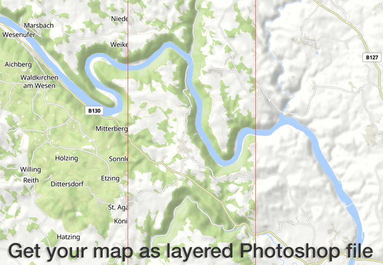
El editor Printmaps produce mapas de alta resolución de 300 dpi en formato PNG, PSD (Photoshop) y SVG. Todas las características del mapa vienen en capas separadas para que pueda editar las características del mapa sin dañar cualquier característica debajo. ver nuestro screencast para más detalles.
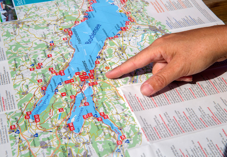
Nuestros clientes utilizan el editor Printmaps para trazar sin esfuerzo rutas -itinerarios de viaje, rutas de senderismo y ciclismo, paseos por la ciudad o simplemente indicaciones- y superponer sus puntos de interés en un mapa. El editor facilita enormemente la creación de mapas plegables, mapas para carpetas y folletos turísticos o mapas de guías turísticas.

Nuestros económicos precios de entrada permiten que clientes con tiradas muy reducidas puedan permitirse nuestros mapas. Algunos ejemplos típicos son las exposiciones inmobiliarias y los libros de fotos, que se imprimen en pequeñas tiradas pero necesitan mapas de ubicación o rutas de alta calidad.
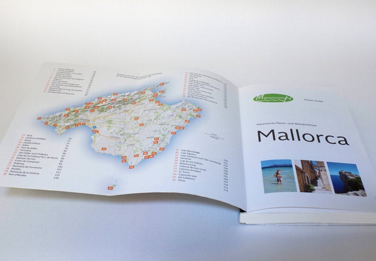
Muchos editores de guías ilustran sus guías de viaje y de senderismo íntegramente con mapas Printmaps. Con nuestros mapas podrá satisfacer todas las necesidades cartográficas habituales, desde mapas de visión general y mapas de ubicación general hasta mapas de actividades con rutas de senderismo o cicloturismo, planos de ciudades / callejeros o mapas de direcciones.
Pruebe Printmaps
Nuestro editor de mapas te permite crear mapas imprimibles de todo el mundo en un abrir y cerrar de ojos.