If you’ve been using screenshots of maps.google.com to get your printable maps until now, you’ll be interested to see how Printmaps.net stacks up compared to printing Google Maps.
We’ve created the below comparison grid to give you a quick overview of some of the most important features of the Printmaps editor and how they compare to using Google Maps screenshots for your printable maps. (Try the editor here.)
| Printmaps | Google Maps Screenshots | |
|---|---|---|
| Resolution | 300dpi, which is high-resolution commonly used for print-products. Fully scalable in SVG format. | The resolution of screenshots was not designed for print-products, the resulting maps are therefore usually blurry when printed. |
| Legality | Creating printable maps with Printmaps is fully legal | Using Google Maps screenshots commercially without permission form Google is against the Google Maps Terms of Service, especially when used as printed navigational material. |
| Pricepoint | Maps start at around €7 | Free (but risking legal consequences) |
| Format | SVG, PSD, PNG | Low-resolution PNG or JPEG |
| Custom Data Tools | * Route Editor * Geographic Shapes * File Upload (GPX/KML/GeoJSON) * POIs (manually or copy/paste from Excel) | * Standard Google Maps routing and POIs |
| Show/Hide Map Features? | Yes | No |
| Rotate or tilt map? | Yes | Only on mobile devices |
Some of the ways our printable maps are used
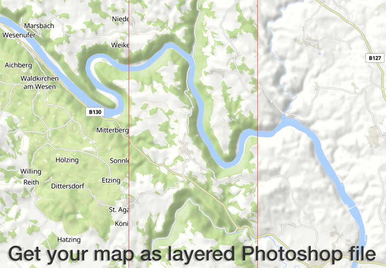
The Printmaps editor produces high-res 300 dpi maps in PNG, PSD (Photoshop) and SVG format. All map features come in separate layers so you can edit map features without damaging any features underneath. see our screencast for more details.
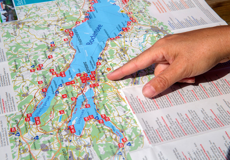
Our customers use the Printmaps editor to effortlessly map routes – travel itineraries, hike and cycle trails, city walks or simply directions – and to overlay their points of interest on a map. The editor makes it really easy to create fold maps, maps for touristic folders and brochures or guide book maps.

Our cheap entry level pricing enables customers with very low print circulation numbers to afford our maps. Typical examples include real estate exposés and photo books, printed in low numbers but needing high quality location or route maps.
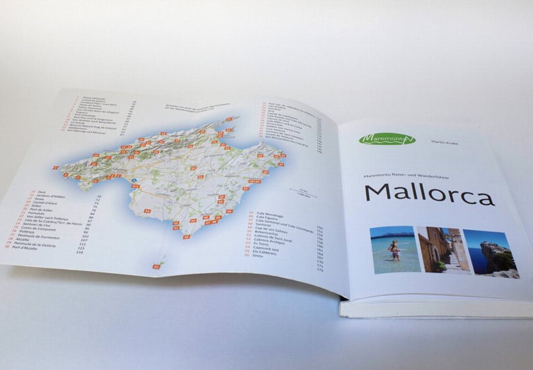
Many guide book publishers illustrate their travel guides and hiking guidebooks entirely with Printmaps maps. You can satisfy all typical mapping needs with our maps, ranging from overview maps and general location maps to activity maps with hiking or cycle routes, city maps / street maps to direction maps.
Try Printmaps
Our map-editor lets you create printable maps worldwide in no time.