Se você tem utilizado capturas de tela do maps.google.com até agora para obter os seus mapas para imprimir, ficará interessado em ver como Printmaps.net se compara à impressão do Google Maps.
Nós criamos a grade de comparação abaixo para oferecer uma visão geral rápida de alguns dos mais importantes recursos do editor Printmaps e como eles se comparam à utilização de capturas de tela do Google Maps para imprimir os seus mapas. (Experimente o editor aqui.)
| Printmaps | Capturas de tela do Google Maps | |
|---|---|---|
| Resolução | 300 dpi, que é a alta resolução comumente usada para produtos impressos. Totalmente escalável no formato SVG. | A resolução das capturas de tela não foi projetada para produtos impressos, portanto, os mapas resultantes geralmente ficam borrados quando impressos. |
| Legalidade | A criação de mapas imprimíveis com a Printmaps é totalmente legal | O uso de capturas de tela do Google Maps para fins comerciais sem a permissão do Google é contra os Termos de Serviço do Google Maps, especialmente quando usado como material de navegação impresso. |
| Preço | Os mapas custam a partir de € 7 | Gratuito (mas com risco de consequências legais) |
| Formato | SVG, PSD, PNG | PNG ou JPEG de baixa resolução |
| Ferramentas de dados personalizadas | * Editor de rotas * Formas geográficas * Upload de arquivos (GPX/KML/GeoJSON) * POIs (manualmente ou copiar/colar do Excel) | * Roteamento e POIs padrão do Google Maps |
| Mostrar/ocultar recursos do mapa? | Sim | Não |
| Girar ou inclinar o mapa? | Sim | Somente em dispositivos móveis |
Algumas das maneiras como os nossos mapas para imprimir são utilizados
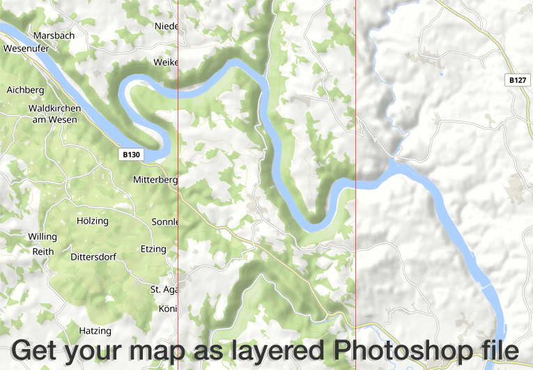
O editor Printmaps produz mapas de alta resolução e 300 dpi nos formatos PNG, PSD (Photoshop) e SVG. Todos os recursos do mapa vêm em camadas separadas para que você possa editar os recursos do mapa sem danificar os recursos abaixo.
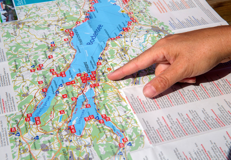
Nossos clientes usam o editor Printmaps para mapear rotas sem esforço – itinerários de viagem, trilhas para caminhadas e ciclismo, passeios pela cidade ou simplesmente direções – e para sobrepor seus pontos de interesse em um mapa. O editor facilita muito a criação de mapas dobráveis, mapas para folders e folhetos turísticos ou mapas de guias.

Nosso preço de entrada barato permite que os clientes com números muito baixos de circulação impressa tenham acesso aos nossos mapas. Os exemplos típicos incluem exposições imobiliárias e álbuns de fotos, impressos em baixa tiragem, mas que precisam de mapas de localização ou de rotas de alta qualidade.
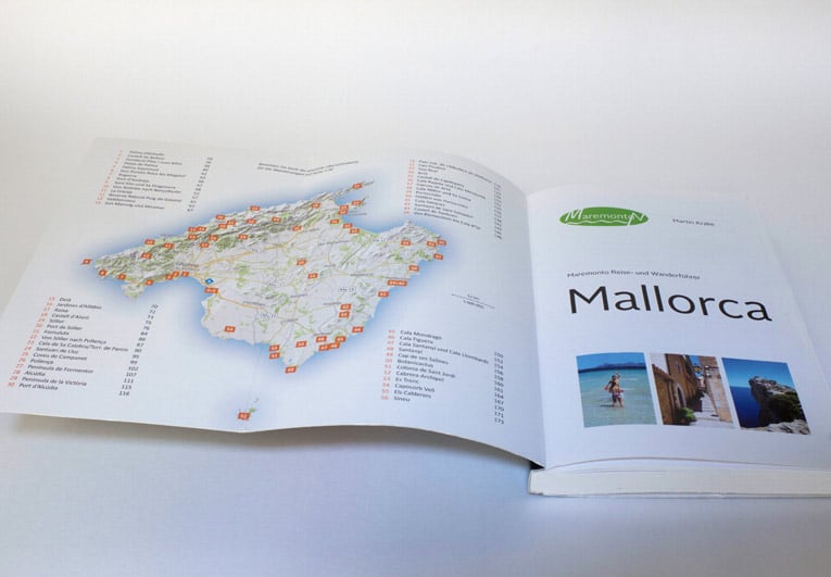
Muitas editoras de livros-guia ilustram seus guias de viagem e guias de caminhada inteiramente com mapas da Printmaps. Você pode satisfazer todas as necessidades típicas de mapeamento com nossos mapas, que vão desde mapas de visão geral e mapas de localização geral até mapas de atividades com rotas de caminhada ou ciclismo, mapas de cidades / mapas de ruas e mapas de direção.
Experimente Printmaps
O nosso editor de mapas permite que você crie mapas de todo o mundo para impressão em um instante.